
Baraveha [Knockanefune] [Barr an Bheithe]
Good walks are even better shared.
Overview
Baraveha [Knockanefune] [Barr an Bheithe]
Nestled delightfully in the lush landscapes of Co. Kerry, Baraveha stands tall at an elevation of 546 meters, beckoning hikers with its rugged charm and breathtaking views. Often overshadowed by its taller cousins in the MacGillycuddy's Reeks, this Marilyn is a hidden gem just waiting to be explored.
Geology
The underlying sandstone of Baraveha bears witness to the forces of nature, revealing layers from the earth's distant past. Glacial scarring is evident, and the fascinating rock formations scattered along the trail provide excellent subjects for budding geologists and photographers alike. Each step echoes tales of ancient sea beds and dramatic geological upheavals.
Routes
The Green Road Trail: Ideal for those who fancy a gentle start with a moderate ascent leading to panoramic views of the surrounding valleys. The trail winds through vibrant pastures, and sheep may provide unsolicited companionship along the way!
- Distance: 6.5 km
- Estimated Time: 3.5 hours
- Difficulty: Moderate
Summit Ascent via Cnoc an Tí: Perfect for those craving a challenge. This steep ascent will test your mettle, but the reward is a blanket of stunning scenery at the top.
- Distance: 3.0 km
- Estimated Time: 2.0 hours
- Difficulty: Challenging
Summit Features
Upon reaching the summit, hikers are greeted by a sturdy cairn and a trig point. They act as benevolent guardians of the views ahead, perfect for capturing a sense of triumph.
Terrain
Expect a diverse mix of terrains. Rocky outcrops challenge your footing while grassy slopes invite you to take a breather. Beware of the boggy patches that might swallow up unsuspecting hikers – a true test of agility!
Views
From the rocky heights of Baraveha, a stunning 360-degree panorama awaits. You can gaze upon the grandeur of the MacGillycuddys, the reflective waters of Lough Leane, and the undulating hills of Killarney National Park. For the best views, aim for spring or autumn when the air is crisp.
Hazards
Remember, the weather in Ireland is notoriously unpredictable, transforming a sunny day into a soggy ordeal. Slippery rocks combined with the joys of uneven terrain demand caution. Pack accordingly and tread lightly!
Access
A small layby on R111085 can accommodate a few cars, but do show consideration for your fellow adventurers. Public transport is limited, so consider arranging for a taxi to the trailhead if you rely on transport.
Facilities
Once your adventure wraps up, indulge yourself in the cafes and pubs of Killarney. It’s the perfect chance to swap stories with fellow hikers over a well-deserved drink!
History
Etymologically, the name ‘Barr an Bheithe’ recalls the once prolific birch woods that thrived in the area. Historically, this mountain serves as a cultural landmark, a sacred site for generations, where local folklore whispers of ancient gatherings.
Conclusion
Baraveha offers a captivating experience for hikers of all levels. With its blend of fantastic vistas, intriguing geology, and a sprinkling of history, it’s more than just a hike – it’s a journey into the heart of the Irish landscape.
Grab your gear and head out to explore Baraveha and its secrets today!
Explore routes near Baraveha [Knockanefune] [Barr an Bheithe]
Public walks starting within 80 km of this hill. Nearby does not mean a route reaches the summit; check its map and access before setting out.
No public routes are currently listed within 80 km of Baraveha [Knockanefune] [Barr an Bheithe] on Walkmates. This does not mean there are no paths here. Explore the map and check local access information before planning a walk.
Route planning notes
These notes describe possible approaches, not verified navigable routes or permission to cross land. Check current paths, local access rules and conditions before setting out.
The Green Road Trail
A scenic route starting from the R111085, weaving through lush valley pastures and climbing steadily toward the summit.
Summit Ascent via Cnoc an Tí
A more direct ascent that provides breathtaking views and a bit of a scramble near the top.
Make a day of it, together
Find someone to share the walk with, or organise a day out along a route you like.
Hill facts and local notes
Classifications
Elevation
451m
1,480 ft
Prominence
294m
Coordinates
52.2216, -9.3016
R111085
OS Map
72
At the Summit
The summit boasts a prominent cairn and a stunning trig point, perfect for that Instagram shot if you can catch your breath.
Terrain & Geology
Primarily composed of sandstone, which has been shaped by glacial activity. It showcases intricate rock formations that tell tales of the ancient past.
Views & Scenery
Stunning panoramas of the MacGillycuddy's Reeks, Lough Leane, and the sweeping beauty of Killarney National Park.
History & Heritage
Name Origin
The name 'Barr an Bheithe' translates to 'Peak of the Birch', pointing to the flora that was once dominant in the area.
Historical Significance
Long regarded as a sacred site by the local community, with tales of ancient rituals and gatherings held at its base.
Getting There & Facilities
Check current local access restrictions, parking rules and transport timetables before travelling. These notes do not confirm public access to the summit.
Parking
There is a small layby along the R111085 with space for a few cars. Make sure to park responsibly!
Public Transport
Bus services from Killarney to nearby towns; however, a taxi may be needed to the trailhead.
Nearby Facilities
Cafes and pubs can be found in Killarney, with nice refreshments upon your return to replenish those worn-out legs.
Safety Information
Known Hazards
- Weather can change rapidly, so pack a waterproof just in case. Slippery rocks and uneven terrain also await the unsuspecting hiker.
General Safety Tips
- Check weather conditions before setting out
- Carry appropriate clothing and equipment
- Let someone know your planned route
- Take a map, compass, and GPS device
- Carry emergency supplies: food, water, first aid kit, torch
Hills
Some common questions about the hills answered
Are there group walks up Baraveha [Knockanefune] [Barr an Bheithe]?
Many walkers use Walkmates to join or organise walks with others. You can check for group walks around Baraveha [Knockanefune] [Barr an Bheithe] through the maps
Are there other walkers around Baraveha [Knockanefune] [Barr an Bheithe]?
Activity varies by location and time, but Walkmates lets you see whether others have shared walks or shown interest in this area. Find other people through the walking friends search walking friends for Baraveha [Knockanefune] [Barr an Bheithe] search or of course create your own walk for Baraveha [Knockanefune] [Barr an Bheithe]
Can I organise a walk to Baraveha [Knockanefune] [Barr an Bheithe]?
Yes. If there aren’t any walks listed already, you can create a walk and make it available for others to join.
If you're signed up to Walkmates, you can create a walk to Baraveha [Knockanefune] [Barr an Bheithe].
How do I find a walk up this hill?
There are often multiple ways to walk this hill, depending on experience and route preference. Walkmates helps you explore walks and routes that others have shared.
Can I suggest a new route up Baraveha [Knockanefune] [Barr an Bheithe]?
Yes. You can suggest or create routes to share with others. Walkmates focuses on the social side of walking, so routes are used to help people organise walks and explore areas together, rather than as detailed navigation tools or route libraries.
Other uses really appreciate knowledgeable walkers sharing their routes. Share your favourite route to Baraveha [Knockanefune] [Barr an Bheithe] here
The is an error or something incorrect about this hill. How do I let you know?
We always strive to keep the information on Walkmates as accurate as possible. If you find an error, please let us know through the contact form and we'll aim to correct it as quickly as possible
Community Discussion
Comments
Location
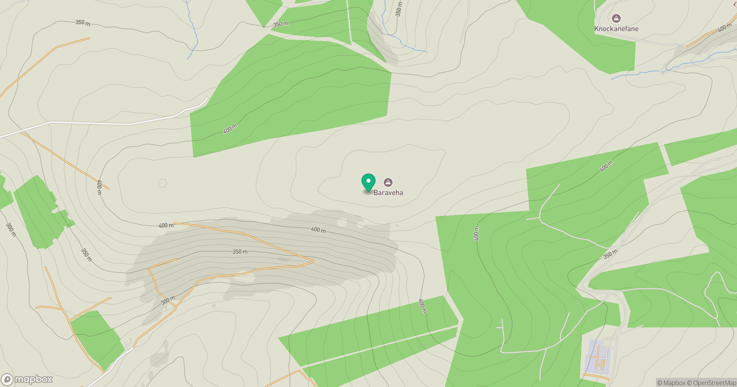
Grid reference: R111085
View on OpenStreetMapOpens a map in a new tab, centred on the hill.
Hills within 30 km
Straight-line distance, not a walking route or confirmation of access.
No comments yet. Be the first.